![]()
![]()
Mapping Deed Processing
The mapping department defines the boundaries of a parcel based on the legal description listed in the deed. The county gathers deed information from the Deed Register and deeds brought in by taxpayers. To ensure accuracy, mappers must pay close attention to what changes are indicated on the deed and then properly translate that information into Capture. This quick help will guide the user through the mapping deed processing.
1. Hover Over Deeds and click My Deeds.

2. Apply filters and click Go.

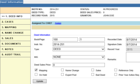
3. Follow the previous steps done for Regular Deed Processing to open a Deed Information dashboard.

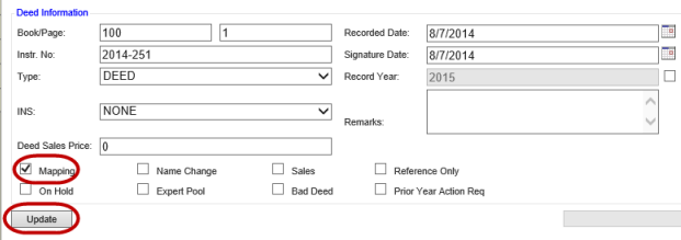
4. Check the parcel actions required by the deed then click Update.

Note: Continue processing the rest of the legal by following the previous steps completed in Regular Deed Processing, in order to process mapping changes or continue to both Merging Parcels and Splitting Parcels Quick helps to finish legal changes. |