![]()
![]()
Basic Map Functions
This help is designed to teach the user to use basic map functions. Through this help a user will learn to search for parcels and print parcel information along with an image from the Maps tab. The user will also learn how to get basic parcel information, how to measure a parcel’s area, how to measure a parcel’s perimeter, and how to zoom in and out of the maps. These functions can be used to quickly view or print parcel information, to reference parcel information when making similar appraisals, or to view similarly appraised parcel data against one another.
1. Log into Capture
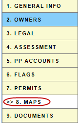
2. Click the Maps tab

Single Parcel Search
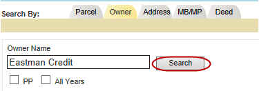
3. Search for Parcel or Account by
a. Parcel/Account Number
b. Owner Name
c. Address
d. MB/MP
e. Deed
4. Click Search
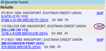
5. Click the Map hyperlink next to the appropriate parcel
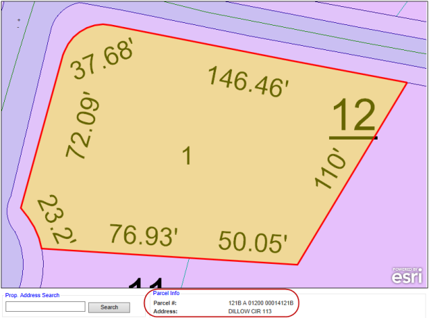
a. The parcel is highlighted yellow
b. The parcel is outlined in red
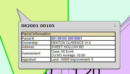
c. Basic Parcel Info is found beneath the map
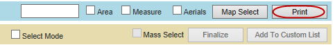
6. Click Print to print the map and parcel information
Note: The Parcel Info beneath the map will not update when another parcel is clicked. You must search for a new parcel to update the Parcel Info
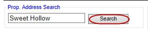
7. Search for a different parcel using the Prop. Address Search box beneath the map
a. Type in the property address
b. Click Search
8. Click Select next to the correct address on the Property Address Search records page pop-up

| Note: All properties with full or partial address will be shown in the search results including deleted parcels (shown in red). Deleted parcels cannot be selected. |
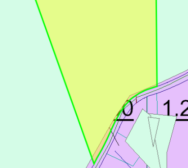
9. The new parcel will be outlined in green
Accessing Maps Through the PRC
1. Open a parcel
2. Click on the Maps tab
Map Tools
1. Click on the highlighted parcel to get a Parcel Information pop-up
2. Click on the Parcel # hyperlink to access the PRC
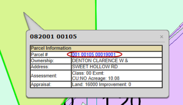
Note: Clicking on additional parcels will generate a Parcel Information pop-up for those parcels. These parcels will be outlined in black
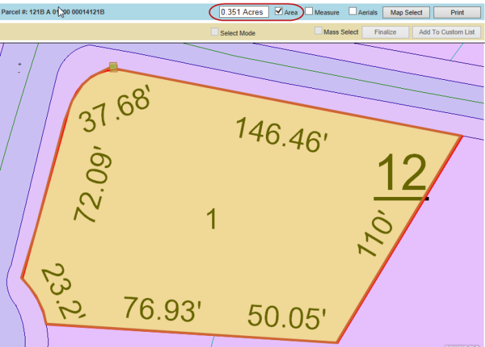
3. Check the box next to Area then click around the perimeter of the parcel to measure the area in acres
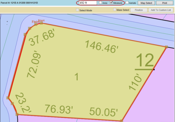
4. Check the box next to Measure then click around the perimeter of the parcel to measure the perimeter in feet – the last click should be on the Start point to get the full measurement
5. Use the + and – signs on the top left corner of the map to zoom in and out
![]()
Confidential | Copyright © 2001-2015 E-Ring, Inc.