![]()
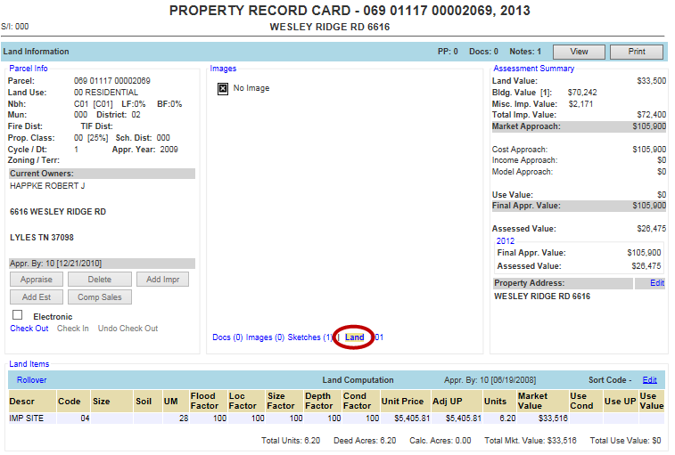
Land Information
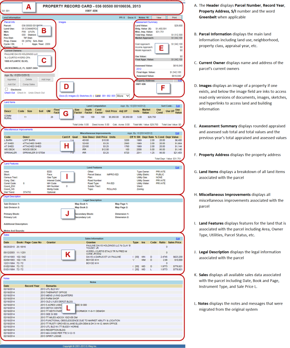
The Land Information page lets the user quickly find land information that is located on a selected parcel record. The information is broken into sections of related data and selecting a hyper-region or links accesses the add and update screens. Land Information is seen by default when the Parcel Information Dashboard is opened or when the Land hyperlink is selected.
Note: Land Information is brought up by default when opening the General Info tab of any Parcel Information Dashboard. |
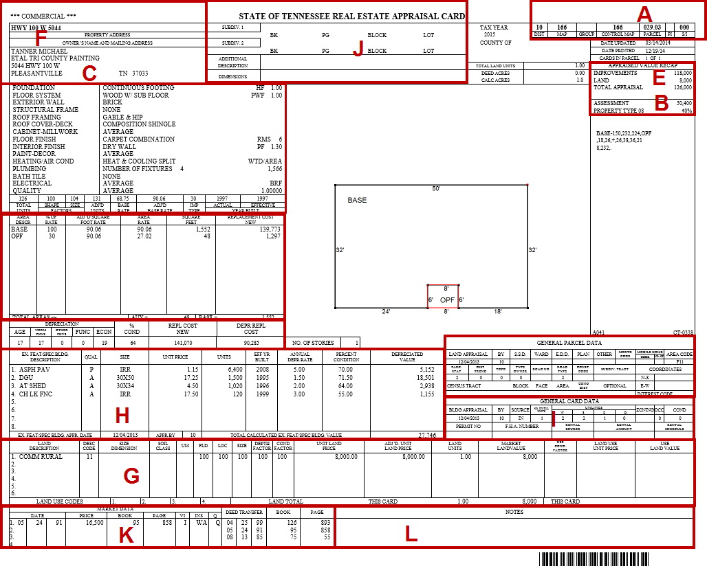
To compare the Capture PRC to the printed PRC, click the appropriate link below:
Kentucky
Accessing Land Information – Locate Parcel Land Information
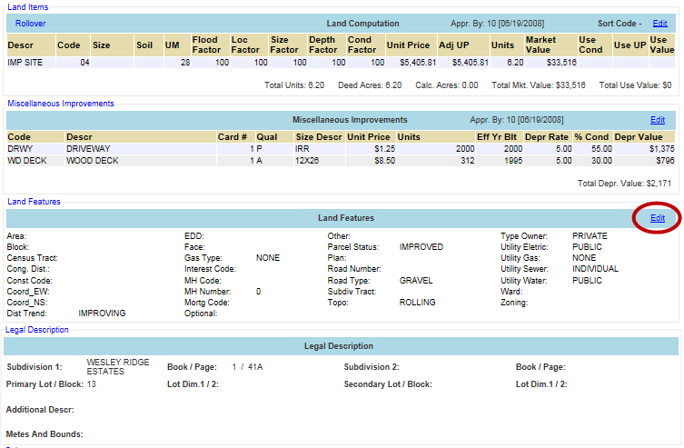
Below are the sections in the Land page of the Parcel Information Dashboard, including Miscellaneous Improvements and Sales Information:
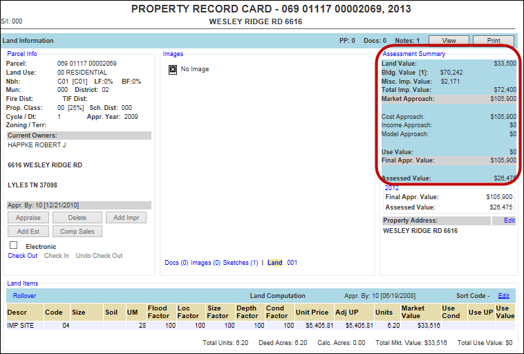
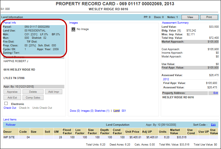
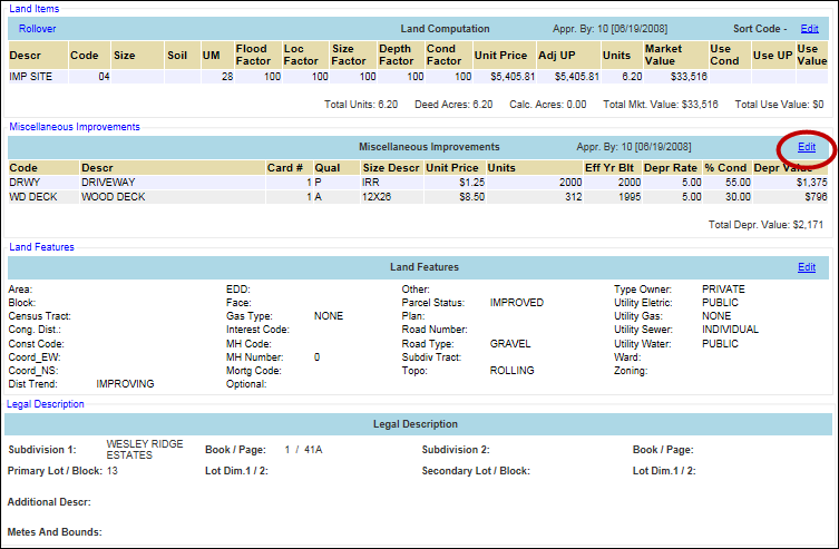
Land Information: Click either the Parcel Info hyper-region, Assessment Summary hyper-region, or the Edit link for the Land Features section to display the information and edit screen. All links open the Land Info Update page with information like Land Use, Area, Utility Information, etc., and a list of Land Items that exist on the parcel. Click the Cancel button to return to the main Land screen.
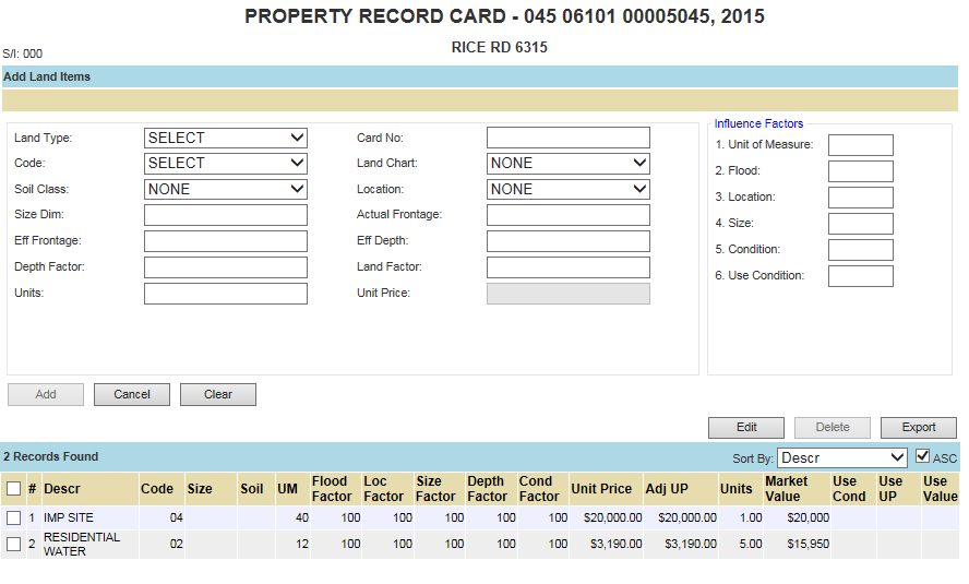
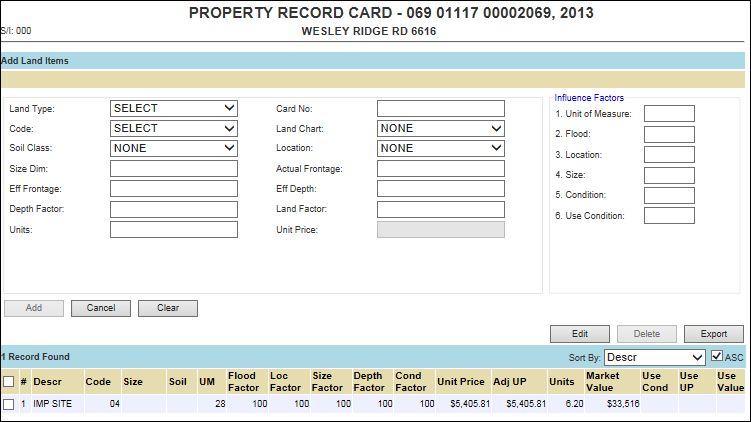
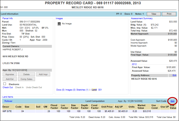
Land Items: Click the Edit hyperlink for the Land Items section to display the Add Land Items screen with information like Land Type, Soil Class, Influence Factors, etc. Click the Cancel button to return to the main Land screen.
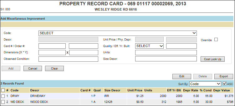
Miscellaneous Improvements: Click the Edit hyperlink of the Miscellaneous Improvements section to display the Add Miscellaneous Improvement screen, which includes a list of all miscellaneous improvements that exist on the parcel. Click the Cancel button to return to the main Land screen.
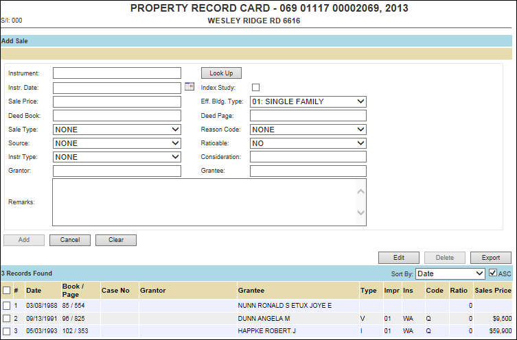
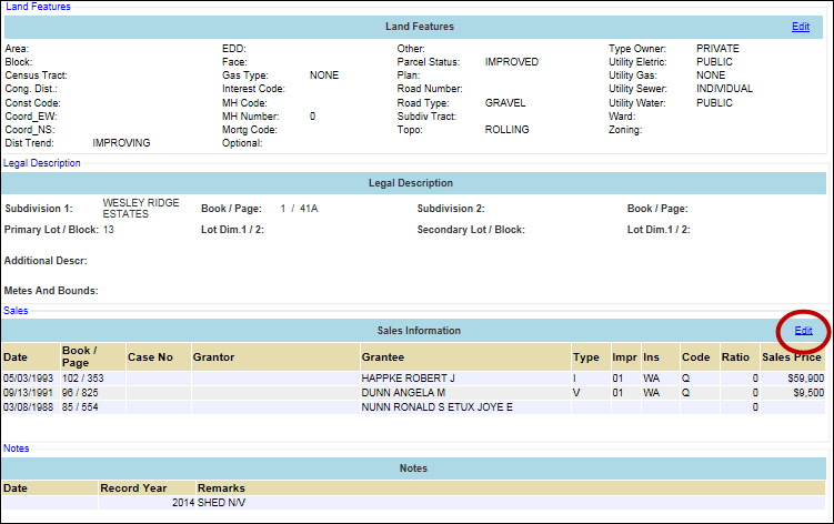
Sales Information: Click the Edit hyperlink of the Sales section to display the Add Sales screen, which includes a list of sales associated with the parcel. Click the Cancel button to return to the main Land screen.
![]()
Confidential | Copyright © 2001-2015 E-Ring, Inc.